
 Image source, BBC Weather Watchers / GSDMARK
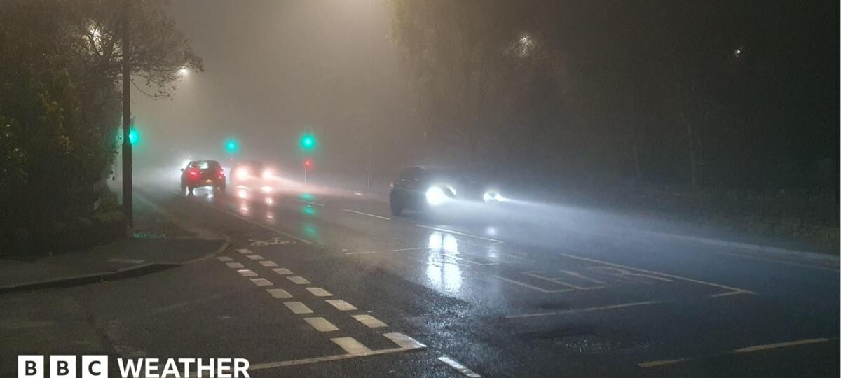
Thick fog has formed on Friday morning across parts of the United Kingdom which could lead to hazardous driving conditions.
The Met Office has issued a yellow severe weather warning for fog from Lincolnshire, the East Midlands, the Home Counties into parts of Greater London.
Fog will be dense in places with visibility below 100 metres at times and it will be most extensive and disruptive during the morning rush hour.
It will slowly begin to thin, lift and clear later this morning but in some rural spots in eastern England it may not clear until this afternoon.

Met Office severe weather warning for fog issued on Friday morning
The weekend forecast
Early morning mist and fog patches on Saturday may lift into low cloud, which could hang around all day.
Some areas will fare better with some spells of sunshine with many areas staying dry.
The exception to this theme will be north-west Scotland, where a weak weather front will bring thicker cloud and rain for a time.
Temperatures will be close to average and will be overall, similar to recent days.
By Sunday this dying weather front will bring some thicker cloud to Wales and central England threatening a few patches of light rain or drizzle, but not much.
The rest of the UK will have a dry day on Sunday with variable cloud and some spells of sunshine at times.

With drier weather people will should be able to get out and enjoy the autumn colours
When will we see Storm Chloe?
High pressure has been building and is set to dominate across the UK in the coming days.
This is in stark contrast to last week which saw areas buffeted by a cluster of storms developed by a powerful Atlantic jet stream.
The jet stream, still running close to the UK, with the building area of high pressure bringing us much quieter weather.
Whilst Storms Austen and Boelo provided some short-term hydrological benefit, 82% of England remains in drought status according to the Environment Agency.
The area of high pressure will stay over or close to the UK for at least ten days as a result of a ‘diffluent blocking pattern’ forming in the Atlantic jet stream across the UK and western Europe, which will prevent weather systems reaching our shores.
It means we are heading into a long stretch of mostly dry weather. There could still be some patches of low cloud and drizzle associated with early morning mist and fog, however, rainfall amounts will be negligible.

A blocked jet stream pattern creates a near-stationary area of high pressure next week
With no storms on the horizon any time soon, it is likely to be a while before we see the arrival of Chloe, the next name on this year’s storm list.
In the short-term this lack of rainfall will raise concerns about the drought and low water levels in England’s reservoirs.
Following the latest meeting of the National Drought Group, water companies are being urged to speed up the fixing of leaks and members of the public to take shorter showers and turn off the tap when brushing their teeth.
The Environment Agency (EA) says that 20% more rain than average is needed over the next six months, external for the drought to end.
Philip Duffy, Chief Executive of the Environment Agency, said: “The recent rain is welcome, but the drought isn’t over. A few wet days cannot reverse months of hot, dry weather.
“Our rivers, reservoirs and groundwater need sustained rainfall to recover, and the effects on nature can last much longer.”
El Niño has been linked to wetter and stormier weather in late autumn and early winter. The current three month outlook from the Met Office forecasts that there is double the chance of it being wetter than normal.
New storm names for 2026-2027 released by Met Office
Stormy autumn, cold winter – how might El Niño affect the UK weather?
Discover more from NAIRAVOICE.COM.NG
Subscribe to get the latest posts sent to your email.