


- Wildfires began ravaging southwestern France in mid-July following record heat waves.
- Satellite images show heavy smoke, and aerial photos show damage to cities and forests.
- France deployed 250,000 firefighters and aircraft, including water bombers and A400Ms.
French Interior Minister Laurent Nuñez said in a statement on Friday that 116,085 hectares of land had burned in wildfires across France this year, amounting to the country’s worst wildfire season on record.
Around 250,000 people have been evacuated in the affected areas of the Gironde and Landes regions of southwest France since the wildfires began in mid-July, France’s Interior Ministry said.
Record-breaking heat waves across Europe and prolonged drought conditions have contributed to the severity of the damage.
Photos show plumes of smoke visible from space, burned remains of neighborhoods, and France’s continued firefighting efforts.
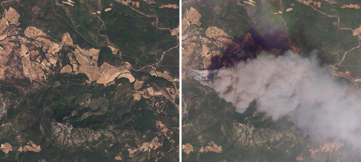
A satellite photo of Pontevès, France, taken on July 19, before the wildfires broke out, showed the valleys, vineyards, and landscapes that have made it a tourist destination.

This satellite photo from July 21 showed thick smoke clouds from active wildfires engulfing the region.

On the ground, firefighters in Pontevès deployed hose teams to put out remaining flames and prevent reignition in the blackened forests.

Before the wildfires, a satellite image taken near Le Porge in Nouvelle-Aquitaine, France, on July 21 showed parts of the coastal village and surrounding pine forests.

Just two days later, satellite imagery showed wildfires producing plumes of smoke.

Le Porge was devastated by the wildfires, its streets strewn with the charred remnants of homes and vehicles.

Smoke from nearby wildfires cast a yellow haze over the French city of Bordeaux, known for its Gothic architecture and red wine.

The Bordeaux Exhibition Center was converted into an emergency shelter for evacuees, offering food, medical care, and psychological services.

Smoke-filled skies glowed orange over Arès in the Gironde department in southwestern France.

Over 250,000 firefighters continue to work across France to contain and extinguish the flames, the French Interior Ministry said.

The French government also deployed aircraft, including Canadair water bombers, Dash 8 aerial firefighters, and French Air Force A400M military transport planes, to aid firefighters on the ground.
Discover more from NAIRAVOICE.COM.NG
Subscribe to get the latest posts sent to your email.